Mombasa floods every rainy season — a solar-powered Raspberry Pi could warn Tudor, Kisauni, and Likoni before the water reaches their doors
Mombasa's flood-prone neighbourhoods — Tudor Creek, Kisauni, Likoni, Bangladesh, and sections of the island — flood reliably during the long rains. The county government issues warnings, but they arrive too late for households in low-lying areas. A network of solar-powered Raspberry Pi devices with water level sensors, cameras, and LoRa radios — each costing under KES 10,000 — could detect rising water levels in real time, transmit alerts without internet, and give residents the minutes or hours they need to move belongings and evacuate. This article explains how edge AI flood monitoring works, why it is affordable enough for community deployment, and how the same hardware can protect construction sites in flood-prone coastal zones.
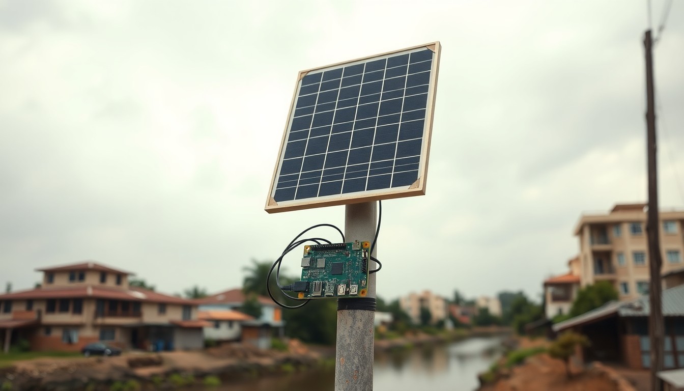
The flood map of Mombasa — and why the warnings come too late
Every long rains season, the same neighbourhoods in Mombasa flood. Tudor Creek overflows into the informal settlements along its banks. Kisauni's low-lying sections become impassable. Likoni's drainage channels back up and spill into homes. Bangladesh and sections of Mvita constituency see water rising faster than residents can move their belongings. The county government's disaster management unit issues warnings based on meteorological forecasts, but the forecasts tell you when it will rain — not which street will flood, how fast the water will rise, and whether your home is in the path.
The gap between a weather forecast and a flood warning is the difference between general information and actionable intelligence. 'Heavy rain expected in Mombasa County' tells a family in Kisauni nothing useful. 'Water level rising at Kisauni Bridge — 50 cm and increasing at 5 cm per hour — expect flooding in Mwandoni area within 90 minutes' tells them to move now.
Closing that gap requires sensors in the flood-prone locations, connected to a system that can process the data locally and distribute alerts without relying on internet connectivity that may itself be affected by the flood. This is exactly the problem class that edge AI and low-power radio solve.
The hardware exists. The software is open-source. The cost is within reach of a community association, a county ward development fund, or a development partner. What is missing is the deployment — and the awareness that the technology is no longer experimental.
The hardware: a solar-powered flood sentinel for under KES 10,000
A flood monitoring station consists of five components. A Raspberry Pi Zero 2W — the brain of the station — costs approximately KES 2,500 and runs on less than 2 watts of power. An ultrasonic distance sensor — the HC-SR04 — costs KES 400 and measures the distance to the water surface, from which the water level is calculated. A small solar panel and battery pack — KES 3,000 — powers the station indefinitely without mains electricity. A LoRa radio module — KES 1,200 — transmits water level readings to a community receiver station up to 5 kilometres away. A waterproof enclosure — repurposed from a food container or electrical junction box — costs KES 500. Total hardware: approximately KES 7,600-10,000 per station.
The station mounts on an existing structure — a bridge pier, a power pole, a building wall — at a known height above the normal water level. The ultrasonic sensor points downward at the water. The Raspberry Pi takes a distance reading every five minutes, calculates the water level, and compares it against pre-set thresholds: normal, watch, warning, and emergency.
When the water level crosses the warning threshold, the LoRa radio transmits a short data packet to the community receiver. The receiver — another Raspberry Pi located in a community centre, a mosque, a church, or a chief's office — processes the alert and can trigger a loudspeaker, send an SMS via a connected GSM module, or post to a community WhatsApp group if internet is available.
All processing happens locally on the Raspberry Pi. No cloud server processes the water level data. No internet connection is required at the sensor station. No subscription fee is paid to any service provider. The system operates autonomously on solar power, indefinitely, with no recurring cost after installation.
The community deployment model: why this is not a government project
Government-led flood monitoring systems exist — the Kenya Meteorological Department operates weather stations, and the Water Resources Authority maintains river gauging stations. These are essential for regional forecasting. But they do not provide street-level, real-time flood warning for specific neighbourhoods, and they are unlikely to deploy sensors in every flood-prone community in Mombasa County.
The community deployment model for Raspberry Pi flood monitoring works differently. A community-based organisation — a neighbourhood association, a youth group, a mosque committee, a residents' welfare group — deploys and maintains the sensors. The hardware is assembled by a local technician or an engineering student. The software is pre-configured and loaded onto the Pi. The community receiver is hosted in a trusted location. The alert distribution channel — loudspeaker, SMS, WhatsApp — is chosen by the community based on what works for their residents.
This model has been proven in other contexts. Community-based flood early warning systems using similar hardware operate in Malawi, Nepal, and Indonesia. The technology transfer to Mombasa requires no new invention — only adaptation to the specific geography, the specific flood patterns, and the specific communities.
For construction, the same hardware serves a dual purpose. A developer with a site in a flood-prone area — Kwale County's river valleys, Kilifi's seasonal wetlands, Mombasa's coastal lowlands — can deploy the same sensor station to monitor flood risk to the construction site. The data provides evidence for insurance claims, programme delay justification, and site safety decisions.
What edge AI adds: from threshold alarms to prediction
A simple threshold-based flood sensor triggers an alarm when the water reaches a set level. This is useful but limited — by the time the water reaches the threshold, the flood may already be advancing. Edge AI adds the ability to detect patterns that precede flooding: a combination of rising water level, increasing rate of rise, and rainfall intensity that the model has learned from historical flood events in that specific location.
A TinyML model trained on historical water level data from a specific sensor station can predict, with reasonable accuracy, whether the current water level trend will result in flooding within the next two hours. The model runs on the Raspberry Pi — no cloud processing, no internet, and no latency. The prediction triggers the alert earlier than a simple threshold, giving residents more time to respond.
The model is not complex. It is a time-series anomaly detector trained on water level data from previous rainy seasons. If historical data is not available for a specific location — as is often the case in informal settlements — the model can be pre-trained on data from a similar hydrological environment and fine-tuned with data from the first season of operation.
The same TinyML approach can process images from a Raspberry Pi camera to detect visual flood indicators — water colour changes, debris movement, surface water accumulation — providing a second data stream that confirms or refines the water level sensor reading.
From flood warning to site selection: what this means for coastal development
Flood monitoring is not only a community safety tool — it is a development planning tool. Every year, developers buy land in flood-prone areas of the coast without understanding the flood risk. The land looks dry during the viewing in February. By May, it is under half a metre of water. The developer has already paid for the land, commissioned the designs, and started the approval process.
A network of flood sensors deployed across Mombasa's flood-prone zones produces the data that developers need to make informed site selection decisions. Historical water level data from a sensor 200 metres from the parcel tells you not just whether the area floods, but how deep, how fast, and for how long. This is data that neither the county GIS nor Google Earth can provide.
REDM's plot check includes flood risk assessment from national and county GIS layers. The community sensor network adds ground-truth data at a resolution that satellite-derived flood maps cannot match. The combination of GIS analysis and community sensor data gives the developer the most complete picture of flood risk available before a site visit.
The technology exists. The hardware is affordable. The deployment model has been proven elsewhere. The next step is the first deployment — a single sensor station on Tudor Creek, tested through one rainy season, with the data made open for community use and development planning. Every subsequent station costs less to deploy because the first one has proven the concept.
Next step
Turn this insight into a project decision
Use the free check or calculator while the question is still fresh. If the numbers make sense, continue into report delivery, capture and project setup.
Check your site's flood riskFrequently asked questions
How much does one flood monitoring station cost to build and maintain?
Hardware costs approximately KES 7,600-10,000 per station (Raspberry Pi, ultrasonic sensor, solar panel, battery, LoRa radio, enclosure). There are no recurring costs — no cloud subscription, no data plan, no software licence. Maintenance involves cleaning the solar panel and sensor every few months and replacing the battery every two to three years (KES 1,000-1,500).
Can this really warn people before the flood reaches them?
Yes — if the sensor is placed upstream or at the entry point to the flood-prone area. The sensor detects rising water levels and transmits alerts before the water reaches the residential area. With edge AI prediction, alerts can be triggered based on rate-of-rise trends before the water reaches a critical threshold, giving residents additional warning time.
Who maintains the sensors in a community deployment?
The community-based organisation that deploys the sensors typically assigns maintenance to a trained member — a local technician, a youth group member, or a community health volunteer. The maintenance tasks are simple: cleaning, battery check, visual inspection. Remote monitoring of sensor health is possible if a LoRa gateway with internet backhaul is available, but not required for basic operation.
How is this different from the county government's flood warning system?
The county system is based on meteorological forecasts and provides regional warnings — useful for emergency services but not specific enough for individual neighbourhoods. The community sensor network provides street-level, real-time water level data for specific flood-prone locations and delivers alerts directly to the affected residents through channels they already use — WhatsApp, SMS, or loudspeaker.