Site survey and GIS analysis in Kenya: what spatial data tells you before you build
A boundary survey confirms where your land ends. GIS analysis tells you what you can build on it. Clients regularly confuse the two, commission neither, and discover their constraints after purchasing. This guide explains what each service delivers, when to commission them, and what the fees look like.
Survey and GIS: two different things
Land survey and GIS analysis are frequently treated as the same service. They are not. A land survey is a physical exercise: a licensed surveyor goes to your plot, locates the boundary beacons, measures the distances between them, and produces a plan that confirms the legal boundaries of the land. It is a ground-based exercise that results in physical beacon positions and a plan that can be submitted to the Survey of Kenya.
GIS — Geographic Information Systems — is a data exercise. It uses spatial datasets including satellite imagery, county zoning maps, flood risk layers, infrastructure proximity data, protected area buffers, and environmental sensitivity layers to characterise what can and cannot be done on a given parcel. GIS analysis produces a constraint map that tells you your zoning classification, your setback requirements, your allowable floor area ratio, and any overlays (flood zone, coastal zone, forest buffer, road reserve) that affect development.
A boundary survey tells you where your land ends. GIS tells you what you can build on it. Both are required for any serious development decision, and both should be commissioned before a significant purchase commitment is made — not after.
What a boundary and topographic survey covers
A boundary survey confirms the legal extent of the parcel as recorded in the title and the Survey of Kenya. The surveyor locates existing boundary beacons (or re-establishes them where they have been disturbed), takes total station measurements, and produces a survey plan at an approved scale that can be lodged with the Survey of Kenya and used for building permit applications.
A topographic survey adds elevation data to the boundary survey. Instead of simply recording the boundary, the surveyor also maps the ground surface at intervals, producing contour lines and spot heights. This data is essential for: calculating earthwork volumes (cut and fill for site levelling); designing drainage with adequate slopes; positioning a building on a sloping site without excessive retaining structure; and understanding where groundwater is likely to accumulate.
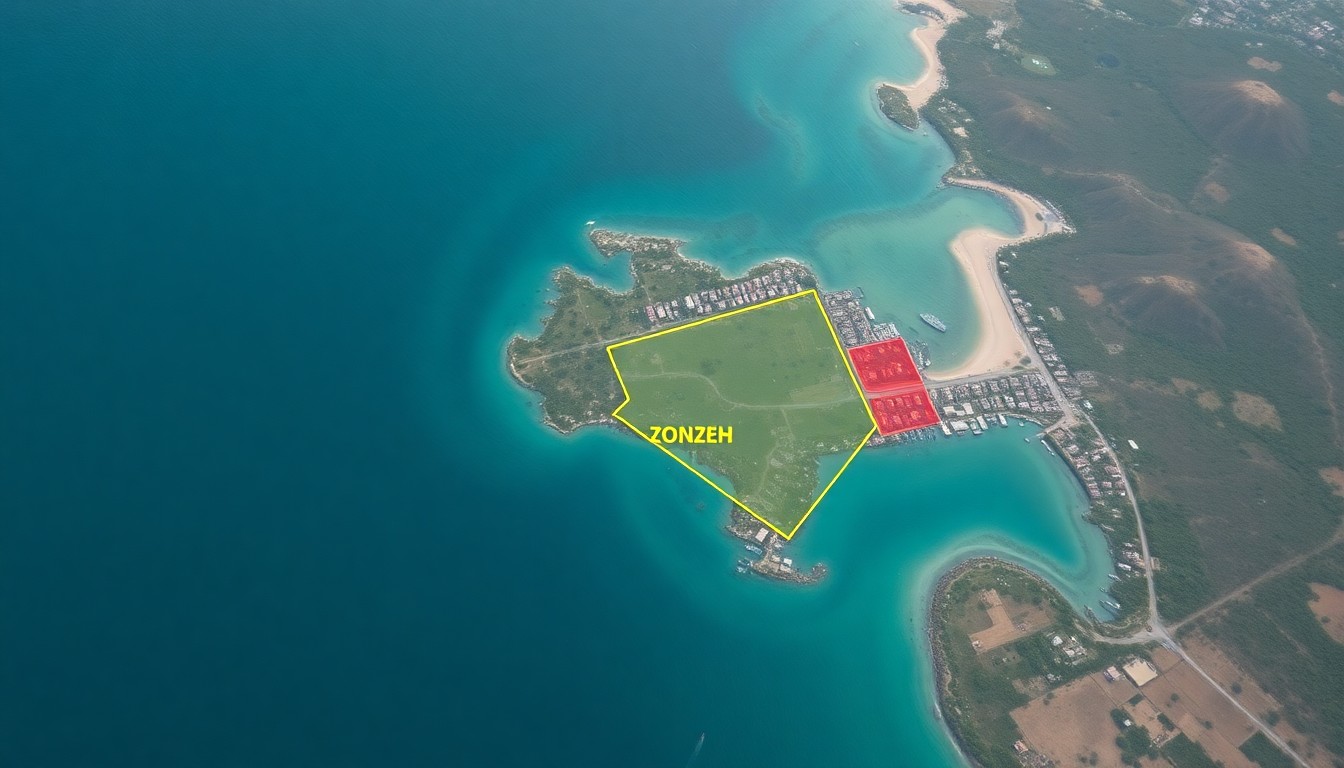
For coastal sites in Mombasa, topographic data is particularly important. Many plots have significant level changes, and the relationship between natural ground level, finished floor level, and the LAPSSET coastal flood modelling data can determine whether ground floor use is feasible without a plinth or flood mitigation measures.
Boundary survey fees in Kenya range from KES 50,000–150,000 for plots below 0.1 hectares, and KES 100,000–300,000 for plots between 0.1 and 1 hectare. Topographic surveys add to this, depending on site area and terrain complexity.
What GIS analysis delivers
GIS analysis pulls together the spatial datasets that determine what you can build on a given site. In practice, a GIS report for a development project in Kenya typically covers the following layers:
Zoning classification: what the county's spatial plan designates for your parcel — residential, commercial, mixed use, industrial, or special purpose. This determines permitted use, height limits, and density.
Floor Area Ratio (FAR) and Plot Coverage Ratio (PCR): how much floor area is permitted relative to the plot area, and what percentage of the plot can be covered by the building footprint. These numbers drive the fundamental development quantum.
Setback requirements: minimum distances from the building to each boundary, which directly constrain the buildable area on small plots.
Infrastructure proximity: distance from the nearest water main, sewer connection, and power supply — which affects servicing costs.
Environmental overlays: proximity to wetlands, forest reserves, riparian buffers (typically 30m from the centreline of seasonal streams), and in Mombasa, the Coastal Development Authority (CDA) setback from the high water mark.
Flood and drainage risk: areas identified as high-risk flood zones under county drainage models, which affect insurance, design, and in some cases, planning consent.
A GIS report for a single parcel in Mombasa will also pull NEMA Environmental Impact Assessment (EIA) threshold data — whether your proposed development scale triggers a mandatory EIA before planning approval can be issued.
The free constraints checker at `/constraints` gives a basic overview of your site's GIS layers. A professional GIS report — part of the full site analysis service — provides the stamped documentation required for planning submission.
The difference between a survey and the title
A common misconception is that the title deed is sufficient to define a plot's extent. The title references a parcel number and a registered plan held at the Lands Registry — but the parcel plan may not match physical conditions on the ground. Beacons may have been removed, encroachments may have occurred, or the registered area may have been subject to subsequent subdivision that has not been fully updated.
In Kenya, boundary disputes are common and expensive. Purchasing land without a fresh survey means purchasing without confirmation that what is on the ground matches what is on the title. An encroachment that removes even 10% of a 0.1-hectare plot can materially affect a development's viability by reducing the buildable footprint.
A fresh boundary survey before purchase — or at minimum as a condition of purchase — is standard due diligence. It should be commissioned alongside the title search and land caution search described in the land acquisition guide. The combination of a confirmed boundary and a clear title is the minimum threshold before committing to a purchase at any significant price point.
When to commission survey and GIS
The right time to commission survey and GIS analysis is during site due diligence — after identifying a plot and before completing the purchase. By that stage you know the location, the approximate plot area, and the likely use. A GIS analysis at this point confirms whether the site can support the development you have in mind. A topographic survey confirms the ground conditions and level change.
Where land is being acquired for a specific development programme — a residential estate, a commercial block, a hotel — the GIS analysis should be run before offer, so the development parameters inform the price negotiated.
On projects that move directly from acquisition to feasibility, the survey and GIS outputs feed into the feasibility analysis: the GIS data defines the maximum development quantum, and the topographic data feeds the earthworks allowance in the cost plan.
If you have a plot in mind and want to understand what it can support, the constraints tool at `/constraints` gives a rapid initial read. For a full professional GIS report with stamped outputs for planning, the project check at `/feasibility/wizard` will scope the right service for your parcel.
Next step
Turn this insight into a project decision
Run the calculator while the question is still fresh — then continue into a full project check if the numbers work.
Run a free site constraints checkFrequently asked questions
Do I need a survey before buying land in Kenya?
You do not legally require one to complete a purchase — but you should commission one as a condition of purchase or as part of your due diligence. A fresh boundary survey confirms that the physical beacons on the ground match the registered parcel plan. It also identifies any encroachments from neighbours. This is standard professional advice for any purchase above KES 5M.
What does a boundary survey cost in Kenya?
Boundary survey fees range from KES 50,000–150,000 for plots below 0.1 hectares, and KES 100,000–300,000 for plots between 0.1 and 1 hectare. The fee depends on plot size, terrain difficulty, the number of existing beacons to be located, and whether the survey is registered with the Survey of Kenya. Topographic survey adds to the base fee.
Who is licensed to do land surveys in Kenya?
Licensed surveyors in Kenya are registered with the Institution of Surveyors of Kenya (ISK). Only a licensed surveyor can certify a boundary survey for submission to the Lands Registry or the Survey of Kenya. GIS analysis may be performed by a licensed surveyor, an architect, or a specialist GIS analyst, depending on the scope.
What is a Floor Area Ratio and how does it affect my project?
Floor Area Ratio (FAR) is the ratio of total permitted gross floor area to the plot area. A FAR of 1.5 on a 0.1-hectare (1,000m²) plot allows 1,500m² of gross floor area. FAR is set by the county's zoning plan and is a fundamental determinant of development value. Understanding your FAR before purchase allows you to calculate the maximum development quantum and therefore the maximum price you should pay for the land.
Is a GIS analysis different from an Environmental Impact Assessment?
Yes. A GIS analysis characterises the site's physical and planning constraints using spatial data. An EIA is a formal assessment of the environmental impacts of a proposed development, required by NEMA for projects above certain thresholds (typically 10+ residential units, or any commercial or industrial development above 5,000m²). The GIS analysis identifies whether your project triggers an EIA requirement. The EIA is a separate, more involved study.