The land acquisition stage in Kenya: what to do from first interest to completing a purchase
Most development failures in Kenya are not design or construction failures — they are acquisition failures. The sequence from site identification to completed purchase determines what the project can achieve and at what cost. This guide covers every step, in order.
Why acquisition is where projects succeed or fail
The most common narrative around failed property developments in Kenya focuses on construction overruns, delayed approvals, or financing problems. These are real issues, but most of them trace back to decisions made at acquisition. A plot bought at too high a price, with an unverified title, in a zone that doesn't support the intended use, with an access road that isn't dedicated — these are acquisition failures. They cannot be fixed downstream.
The acquisition stage runs from the moment a site is identified to the moment the transfer is registered in the purchaser's name at the Lands Registry. It involves a sequence of professional steps that, taken in order, protect the buyer's investment and establish the foundations for everything that follows.
Skipping steps to move faster almost always costs more than the steps themselves. This guide covers the full sequence in the correct order, with what each step delivers and what it costs.
If you have a site in mind and want to understand its development potential, the free project check at `/feasibility/wizard` will give you a rapid read of what the site can support before you commit.
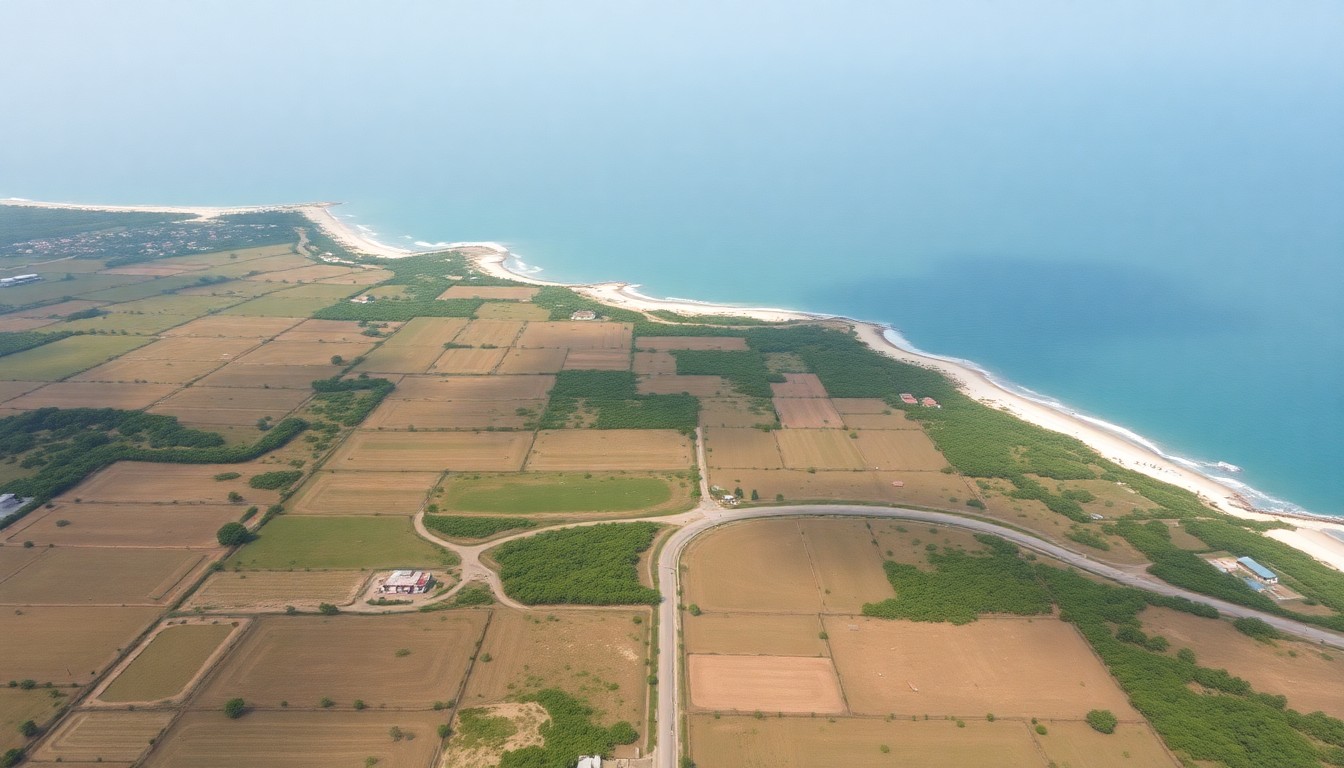
Step 1: Site identification and initial project check
Site identification begins with a clear development brief: what type of building, at approximately what scale, in what location. Without a brief, it is impossible to evaluate whether a given site is suitable. A residential apartment developer needs a different site profile from a hotel operator or a commercial office developer.
Once a candidate site is identified, the first professional step is an initial project check — a rapid desktop analysis that reviews the parcel against known GIS layers (zoning, overlays, constraints) and provides a preliminary view on development feasibility before any money changes hands in the transaction.
At this stage, the questions to answer are: What is the zoning classification? What floor area ratio applies? Are there environmental overlays or coastal setbacks that constrain the footprint? Is road access dedicated or informal? Is there a water and power supply in the vicinity?
The free constraints tool at `/constraints` gives a basic initial read. A professional project check through the REDM platform gives a documented initial assessment that can inform the offer decision.
Step 2: Title search and legal due diligence
Once an initial project check confirms that the site is worth pursuing, the next step is a title search at the Lands Registry. A title search establishes: who currently holds legal title; whether there are any caveats, cautions, or registered interests (charges, liens) against the title; the current tenure type (freehold, leasehold); and if leasehold, the remaining term and annual land rent obligations.
The title search is carried out by an advocate (conveyancing lawyer) and costs KES 5,000–25,000 depending on complexity. It should be conducted before any offer is made, not after. Purchasing land with an undisclosed charge or a caution lodged by a third-party claimant exposes the buyer to a disputed title and potentially years of litigation.
The advocate will also confirm the tenure conversion history (if land was formerly public land now registered as freehold), identify any pending land control board consents required for agricultural land, and check whether the property tax (land rates) is current.
Legal due diligence and the title search are covered in more detail in the land due diligence guide at `/insights/buying-development-land-kenya-due-diligence`.
Step 3: GIS analysis and topographic survey
With a clean title search and a project check confirming initial feasibility, the next step is a professional GIS analysis and — where the site has significant topography or boundary uncertainty — a topographic and boundary survey.
The GIS analysis confirms the development parameters in detail: zoning, permitted floor area ratio, setbacks, environmental overlays, and any density or height restrictions specific to the parcel. It also identifies whether the project will require an Environmental Impact Assessment (EIA) under NEMA thresholds.
The boundary survey confirms the physical extent of the parcel on the ground. Where beacons have been disturbed, encroachments have occurred, or the site has been subdivided informally, a fresh survey will reveal discrepancies between the registered plan and physical conditions. It is better to know this before completing the purchase.
A topographic survey maps the ground levels, which feeds directly into the cost planning for earthworks, foundations, and drainage. On a sloping coastal plot in Mombasa, earthworks can add 5–10% to construction cost if not anticipated in the feasibility.
Survey and GIS fees: boundary survey KES 50,000–150,000 for plots below 0.1 hectares; KES 100,000–300,000 for 0.1–1 hectare. GIS analysis is typically packaged with the site report service.
Step 4: Feasibility study
The feasibility study is the financial and technical validation of the proposed development. It takes the inputs from the GIS analysis (maximum development quantum) and the cost estimates (construction cost per m²) and runs a development appraisal: total development cost versus projected end value, with sensitivity analysis on key assumptions.
A full feasibility study for a residential or commercial development in Kenya covers: site acquisition cost; professional fees (typically 13–18% of construction cost for a full professional team); construction cost (from current m² rates); statutory costs (stamp duty at 4% of market value, NCA levy, NEMA fees, planning fees); finance costs; developer contingency; and projected sale or rental income.
The output is a development appraisal showing whether the project generates a positive return at the assumed acquisition price, and at what sensitivity margins. If the appraisal shows the project is viable, the feasibility study provides the basis for a bank development loan application. If it shows the project is not viable at the proposed price, the client has a documented basis for renegotiating.
Feasibility studies are covered in detail in the guide at `/insights/what-is-a-feasibility-study-kenya`. The REDM feasibility tool at `/feasibility` provides a preliminary development appraisal before a full study is commissioned.
Step 5: Offer, negotiation, and sale agreement
With a confirmed project check, clean title, GIS analysis, and indicative feasibility, the buyer is in a position to make an offer. The offer should be conditional — subject to satisfactory survey, satisfactory title results, and planning pre-application feedback — and should specify the conditions and timeline for going unconditional.
A sale agreement (Agreement for Sale) is prepared by the seller's advocate and reviewed by the buyer's advocate. Key terms include: the purchase price; the deposit (typically 10% on execution); conditions precedent; the completion date; and the allocation of development risk between execution and completion.
It is normal to commission a topographic and boundary survey as a condition precedent in the sale agreement, so if the survey reveals material discrepancies, the buyer can withdraw without penalty. Do not waive this condition for price or timeline convenience.
The advocate will also prepare the transfer documents and coordinate the stamp duty payment with KRA. Stamp duty on the transfer of land and buildings in Kenya is currently 4% of the higher of the market value and the purchase price.
Step 6: Stamp duty, transfer, and registration
After execution of the sale agreement and payment of the deposit, the buyer's advocate prepares the Land Transfer document. The transfer is submitted to KRA for stamp duty assessment. Stamp duty is 4% of the land value as assessed by the government valuer (or the purchase price, if higher). Payment is made to KRA, and the stamped transfer is lodged at the Lands Registry for registration.
The time between lodgement and registration at the Lands Registry varies. In Mombasa, registration typically takes 4–8 weeks under normal conditions. The registered title, with the buyer's name on the green card, is the completion of the legal acquisition process.
Until registration is complete, the purchase is not finlegally concluded. Clients who begin design or construction work before registration carry the risk of a disputed completion or a charge being lodged against the title by a third party. It is standard practice to wait for the registered title before mobilising the design team.
The full acquisition stage — from initial project check through to registered title — typically takes 3–6 months for a straightforward freehold purchase in Mombasa. Complex transactions, leasehold conversions, or parcels with legal incumbrances can take 12 months or more.
Next step
Turn this insight into a project decision
Use the free check or calculator while the question is still fresh. If the numbers make sense, continue into report delivery, capture and project setup.
Run a project check on your siteFrequently asked questions
In what order should I do due diligence when buying land in Kenya?
The recommended sequence is: (1) initial project check and constraints analysis; (2) title search by an advocate; (3) GIS analysis and boundary survey; (4) feasibility study; (5) conditional offer and sale agreement; (6) topographic survey as condition precedent; (7) stamp duty payment and transfer registration. Compressing or reordering these steps increases acquisition risk.
What is stamp duty on land in Kenya?
Stamp duty on land and property transfers in Kenya is 4% of the higher of the government assessed value and the actual purchase price. It is payable to KRA before the transfer is lodged at the Lands Registry. It is one of the largest transaction costs in a land purchase and must be included in the total acquisition cost calculation.
How long does land acquisition take in Kenya?
A straightforward freehold purchase in Mombasa typically takes 3–6 months from initial project check through to registered title. Title searches, GIS analysis, and survey each take 2–4 weeks. Sale agreement execution and deposit payment are followed by a completion period (typically 60–90 days). Lands Registry registration adds 4–8 weeks.
Can I start building before the transfer is registered?
It is not advisable. Until the transfer is registered at the Lands Registry, you are not the legal owner of record. A third party could lodge a caution or charge against the title before your registration completes. Planning permission and building permits also require a copy of the registered title as part of the application. Most professional advisers will recommend waiting for registered title before mobilising the design team.
What is a land caution in Kenya and should I be worried about one?
A caution (or caveat) is a notice lodged at the Lands Registry by a third party who claims an interest in the property — a lender, a co-owner, a purchaser under a prior sale agreement, or a dispute claimant. A caution prevents the title from being transferred until it is lifted. A caution on a title you are considering purchasing must be investigated and resolved before proceeding. Your advocate will identify this in the title search.